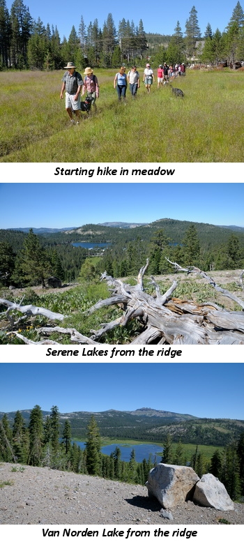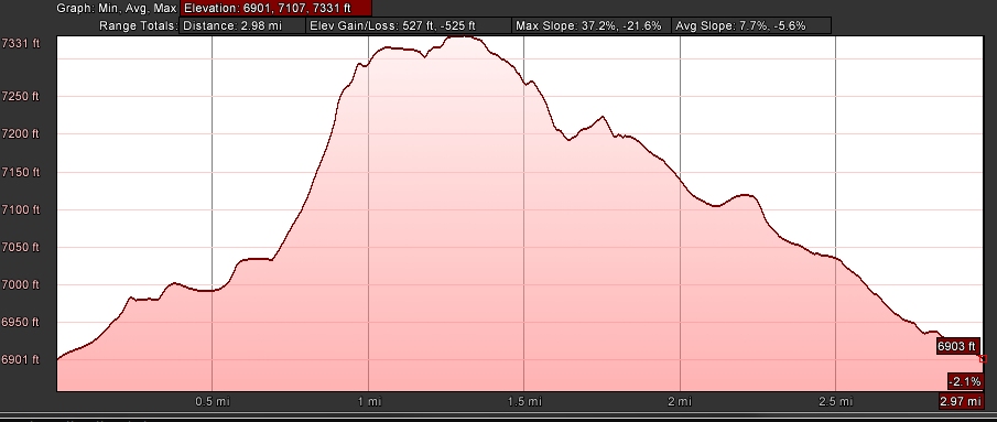
- Distance: 3 miles roundtrip
- Elevation gain/loss: 527/525 ft
- Maximum elevation: 7331 ft
- Difficulty: Moderate (steep climb at west end of ridge)
- Start: Meadow at Soda Springs Rd & Beacon St at Serene Lakes
- Activities: Hike, ski, mountain bike
Forest Service Ridge is the informal name for the ridge on the east side of Serene Lakes that spans east-west to join up with Crow’s Nest and Mt Disney. The ridge affords great views to the south of the Serene Lakes basin and to the north the summit valley and Castle Peak massif.
The trail is a loop that can be done in either direction. Doing it in the clockwise direction (described here) may be more straight forward because finding the trail through the forest in the ccw direction can be a little tricky. The trail starts at the meadow on the east side of Serene Lakes, off of Soda Springs Rd at Beacon Rd. The trail is well worn and easy to follow east through the meadow. Continue east on the trail until it bends to the left (north) and enters the forest. The trail continues through the forest for about a quarter of a mile and then opens up into a beautiful meadow of Mule’s Ear plants that is spectacular in early summer.
At the end of the meadow, as the trail re-enters the forest, turn right (east) into the side trail that climbs up the ridge. This section of the trail is the steepest and most difficult. In late summer it is try and can be loose and slippery, so make sure you wear footwear with good support and traction. At the top of the climb the trail levels out and proceeds straight east along the crest of the ridge. In early and mid summer the wild flowers are abundant with the scent of mint in the air from the Penny Royal growing along the trail. Looking to the right will give great views of Serene Lakes and the surrounding peaks and to the left Van Norden Lake and Meadow stretch out through the summit valley.
The trail transverses the entire ridge and at the east end and gently curves to right and back into the forest heading west, back towards Serene Lakes. This forest is on US Forest Service land and the trail winds through shady groves of old growth forest. In spring and early summer the trail can be wet in places from snow melt. The trail branches at a couple of points and for the most direct route back to the start just keep to the right at each intersection. Eventually the trail comes to the wide logging road that runs north-south. Turn left (north) and follow the trail a short distance and turn left (west) back into the starting meadow and back to the trailhead. (If you get off trail, which is easy to do, just keep heading west and you will end up on the north-south logging road)

