- Distance: 3.7 miles roundtrip
- Elevation gain: 900 ft
- Maximum elevation: 7530 ft
- Difficulty: Moderate (steep climb at top)
- Start: Trailhead across from Ice Lakes Lodge
- Activities: Hike, mountain bike (part way)
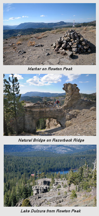
Rowton Peak (39°17’18.84″N, 120°22’26.02″W) is located on the southeast side of Serene Lakes and offers spectacular views of the area. You can start this hike from either the trailhead located at the end of the paved Soda Springs road across from the former Ice Lakes Lodge or from the Hoelter-Hall trailhead located at the south end of Serene Lakes. Follow the Royal Gorge ski trail east and bear right up to the Tiny Tim ski trail from the end of Soda Springs Rd or head south on the ski trail from the Hoelter-Hall trail head. Follow the trail straight south through the Tiny Tim meadow to the junction with the Bogus Basin ski trail. If you are doing this hike in early summer, look out in the meadow and you may see the blue Camas Lilies that grow there. At this point you can either head north up the relatively straight ski trail or up the new meandering trail that the Truckee Donner Land Trust has built along side the ski trail. The direct ski trail is more direct but steeper. The meandering trail is longer but not as steep. Head up the Bogus Basin trail to the top of the ridge that overlooks Serene Lakes. There are benches along the trail at this point where you can get a great view of Serene Lakes. Continue on this trail until the Bogus Basin warming hut.
At the hut turn right (south) up the ski trail towards Razorback Ridge. At this point you can proceed up the ski trail or take the new meandering TDLT trail up to Rowton. If you take the ski trail when you get up to the ridge, go right along the ridge to the top of Rowton Peak. After taking in the views of the Pacific Crest, Soda Springs basin and the Serena Creek Gorge continue northwest down along the ridge heading back towards Serene Lakes. Be sure to keep an eye out on the left for the natural bridge formation on the west side of the ridge (it is a little hard to spot from the trail). Proceed down the trail until it meets with the Bogus Basin trail and retrace your route back down to the trail head.


Pingback:Summer Hikes on Donner Summit | Reno Tahoe Real Estate News