- Distance: 5.1 miles
- Elevation gain: 391 ft
- Maximum elevation: 6748 ft
- Difficulty: Easy
- Start: Parking area of Soda Springs Rd & Lake Van Norden Rd
- Activities: Mountain bike, hike
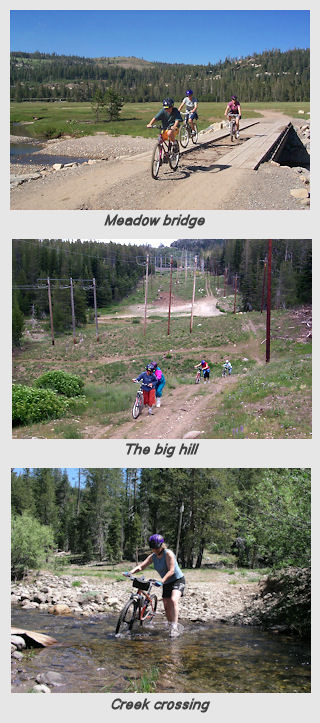
Van Norden Meadow, a prototypical high Sierra meadow, is the largest level area in the Donner Summit area. This makes the trail around it an easy mountain bike ride for all levels of rider. The easiest way to do the ride is from the parking area at the junction of Soda Springs road and Van Norden Meadow road. The ride can be done in either direction, but it’s better in the clockwise direction. The first half of the ride is unpaved Van Norden Meadow Rd. It is a pleasant ride as it winds along the east side of the meadow and is mostly shaded which is nice on warmer days. The road is seldom used even on the weekends. The trail is close enough to the railroad tracks that the trains going by can be seen and heard. About 1.5 miles down the road is the turn off into the meadow at the old sheep corrals (yes sheep used to graze in the meadow). For riders who want to cut the ride in half, turn right at the dirt road across the meadow and pick up the trail on the other side. Make sure you stop at the bridge over the creek and look for toads which can bloom anytime from July to September. To continue the full ride, stay on Van Norden Meadow Rd. At the fork in the road where it crosses the railroad tracks, take the right fork that continues towards Sugarbowl. If you stop at the tracks at the fork you can see the entrance to the Judah tunnel which goes under Judah mountain. About 100 yds up the road towards Sugarbowl, the power lines intersect the road. Turn right into the meadow and follow the track along the power lines as it goes along the west side of the meadow. The riding here is more challenging with a number of small up and down undulations. Early in the summer there can be a lot of puddles (and even an occasional snow patch) and mud. Mid summer is perfect. Later in the summer, the trail dries out and some of the climbs are slippery. About a quarter of a mile down the power line track there is an open area. Bear to the right here and look for a trail that crossed the stream. Early in the summer there can be alot of water here and crossing can be exhilarating. Done later in the summer it is possible to ride through the water to cross. The crossing is not that far off to the right of the trail so if you’ve gone more that 50 yards into the trees, you have missed it.
Once over the creek, the trail climbs to the left back up to the power lines. This little climb is the toughest one on the ride and may have to be walked if it is too wet or too dry. The trail stays along the power lines for the rest of the ride until it connects with Soda Springs Rd. About half way down the meadow is the bridge that crosses the creek on the shortcut road described above. This is a good rest stop with great 360 degree views of the mountains surrounding the meadow. After the bridge stop continue on the power line road. The power lines split as the trail rises toward Serene Lakes. Follow the line road to the right as it parallels Soda Springs Rd. There is a little climb here that can burn the legs. The trail goes down the PG&E transformer platform and then out on to Soda Springs road. Follow the road down to the parking are and if you have time go over and soak your feet in the Van Norden Lake overflow.


 Photo Gallery
Greetings – we live in Soda Springs and haven’t tried the Meadow loop yet. Thanks for posting a great biking suggestion!